This lab was a continuation of last week's orienteering at the Priory. This week, however, was focused on creating a new orienteering course for the next field method's class in the fall. This involved using a GPS, as well as the navigation map used previously in labs 3 (Development of a Field Navigation Map) and 10 (Orienteering at the Priory).
The location of the orienteering course, the Priory, is a plot of land owned by the University of Wisconsin- Eau Claire, located 3 miles south of campus (see figure 1). This site is used for multiple purposes by the university including child care, student housing, and research projects conducted by university students. Most of the 112 acres are wooded, with a small portion of that land being the buildings for housing and child care. This wooded and hilly area provides a great place to hone in on orienteering skills.
 |
| Figure 1. Map of Eau Claire Wisconsin, which highlights the University of Wisconsin- Eau Claire and the Priory. The orienteering area at the Priory is highlighted above. |
During this field day, the weather was absolutely perfect and gave the class a nice bit of sun on the skin. This made determining the precise location of points more thought out in the visibility of the trees from the orienteering direction of travel as well as pleasantness of the activity as a whole.
Methods:
Prior to going out into the field, ArcMap was used to plot roughly where 5 navigation points would be located on the Priory grounds for the orienteering course. The course was chosen based on elevation change, distance from point to point, and ability for the course to be mostly independent from the other courses being made by classmates at the Priory. This map was then exported to the Trimble Juno GPS device so the map could be viewed in the field and the exact GPS points could be taken (see figure 2).
Once at the Priory all of the groups, which were the same as the week before, crosschecked with each other to make sure that the orienteering courses were in different parts of the Priory. Once this was done, every group was given a Sharpie and pink tape. These would be the means in which to mark the trees that served as the individual navigation points. Prior to entering the field, the group referenced the points taken on the Juno prior to getting into the field and placed them roughly where they should have been placed on the map. This allowed the group to 'orienteer' to the points that were tentatively marked on the map. Our group number was 3, so all of the navigation points are marked 3.1. 3.2... (see figure 3).
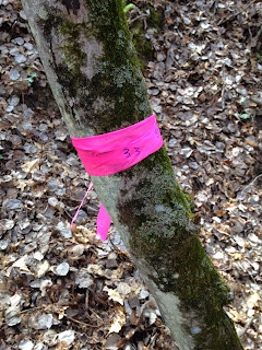
At each navigation point, the pink tape was wrapped around the tree roughly 5 feet off the ground. On the tape, Sharpie was used to identify which navigation point was which on the course. A picture was then taken of the tree and the Juno was used to create a GPS point on the exact location of the navigation point (see figures 4 through 7).
 |
| Figure 4. Navigation point 3.1. The number of the navigation point was marked in Sharpie on the tape. |
 |
| Figure 5. Navigation Point 3.2. |
 |
| Figure 6. Navigation point 3.3. |
 |
| Figure 7 . Navigation point 3.5. |
Once all of the points were collected in the field, the Juno data was imported back into ArcMap to be made into an orienteering course map (see figure 8).
Discussion:
Because of the dense tree cover it was initially difficult to get a signal to show up for the GPS. The Juno worked fine throughout the lab after walking into a clearing and giving it time to find a signal.
Once reconnecting the Juno to the desktop, it took quite some time to be able to import the data. The device said that no information could be checked in because the file type was unable to be exported. After a lot of troubleshooting done by one of my group members, the data was finally able to be imported.
After completing the field portion of this lab, it was interesting to hear how other groups found their predetermined navigation points. One group used the locator arrow on the Juno and followed it to their predetermined point. By using this, they did not have to go through the means of actually orienteering.
Conclusion:
I really enjoyed partaking in the entire process of completing a navigation map for an orienteering course, doing the actual orienteering, and then making my own orienteering course based on all of the skills learned in previous labs. I liked the refresher on how to use the Juno in the field and the combination of old school map and compass work of orienteering combined with the hi-tech use of the Juno to map GPS points. It makes you realize that you need to know how to use new technology as well as remain familiar with using a map.
I recently went on another orienteering course in northern Minnesota, and I soon realized that the points were 'off' in relation to the course. Because of that, I spent over 30 minutes attempting to find a point that was supposed to be located along a power line, which should have been easy. However, it was not located between the contour lines it should have been, so my ability to complete the course was affected.


No comments:
Post a Comment